How LiDAR Data Can Support Efficient Plantation Management
Plantations are a sustainable way of producing timber and fiber raw materials for humankind. Effective plantation management requires up-to-date information on timber size, quality, and total stock, hence, professional plantation managers increasingly use LiDAR data as the main information collection tool.
How LiDAR Data Can Support Efficient Plantation Management
Plantations are a sustainable way of producing timber and fiber raw materials for humankind. Effective plantation management requires up-to-date information on timber size, quality, and total stock. Annually, more plantation managers turn to LiDAR-based forest inventories in this critical information need allowing more precise plantation management and better revenues. The data collected from plantation inventories is invaluable for making informed management decisions, such as selecting areas for thinning or harvesting, estimating timber yields, and identifying areas that require replanting but also for the selection of the most productive and damage-tolerant origin and clone. As a bonus, this data can be used to assess the health and growth of the trees and estimate the volume and quality of timber.
What issues to consider when managing a plantation?
There are essentially three types of forests: boreal, temperate, and sub-tropical/tropical. Each type of forests has a different prevailing tree family and unique challenges, associated with managing them:
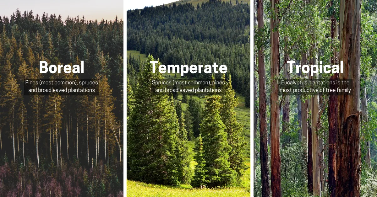
- The main limiting factor on plantation business in boreal zone is slow growth of plantations, leading to a long-term investment and business scope.
- Plantations in temperate zone tend to be more prone to insect and fungus epidemics. Hence, forest management in temperate zone must take the forest health into special consideration.
- In tropical and subtropical eucalyptus plantations, optimized use of clones on each soil and consideration of the local legislation are often the main management factors. Correspondingly, tropical and subtropical pine plantations focus on the pruning and production of high-grade mechanical and chemical raw materials, causing specialized information requirements.
For any tree plantation, some questions need to be answered for viable management. First, a biometrically solid, scientifically proven measurement methodology will provide the necessary basis for decision-making and reporting. Secondly, transparent valuation and value generation monitoring will allow funding availability and effective land use. On all plantations, precise stand boundaries, necessary for accurate measurements, when combined with decision-centred maps provide effective operations and a safe working environment.
Transforming plantation management practices with digital data
LiDAR technology uses pulsed lasers to generate precise, high-resolution, and three-dimensional digital twins of forests, and is well-known for its exceptional benefits:
- Accuracy: LiDAR provides accurate measurements of individual tree characteristics, like height, crown diameter, and tree health.
- Efficiency: Modern sensors are capable of covering very large areas spanning hundreds or thousands of hectares with high-density data in a swift manner.
- Cost-efficiency: LiDAR allows for the measurement of trees at a distance from the sky, reducing the need for ground data collection.
However, even with all the benefits, not all LiDAR plantation mapping projects have been successful. Unprofessional biometrics, use of the wrong sensor equipment for the task, and untimely or unorganized purchase process of the mapping and inventory are some of the reasons that lead to less productive exercises.
Common practices at Arbonaut for efficient plantation inventories
Stand delineation
Stand area errors easily generate 10-20% summary errors on stand level if the boundaries are not well-defined. Arbonaut uses automatic stand delineation tools that fit the stands on the tree map like a glove, reporting just the right size and allowing those extra hectares to be utilized. Manual quality control and edits are then applied by our experts to ensure that data is as precise as it should be.
Biometrics and sampling
Biometrics is the science of measuring biological objects while sampling is the key tool to ensure the measurement is correct and the accuracy is known while keeping production costs in control. For 25 years, Arbonaut has put emphasis on top-level biometric and sampling approaches to produce timber measurements from LiDAR data.
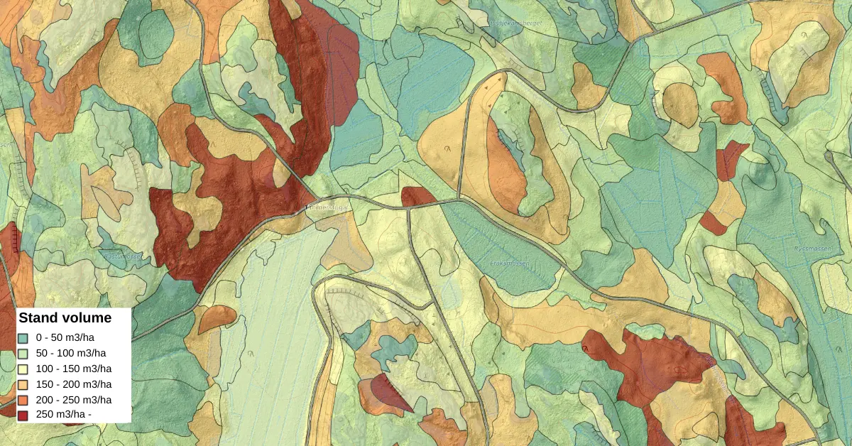
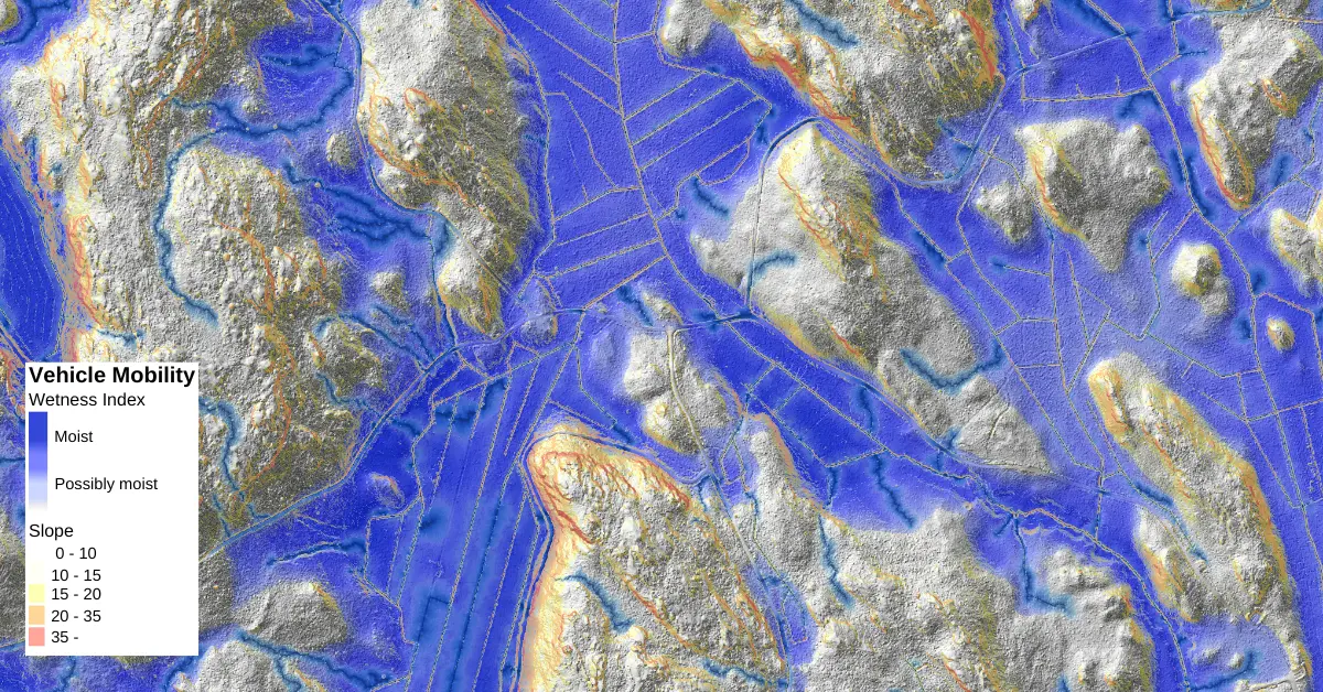
Operational maps
The business advantage of operational maps is often one of the main reasons to use LiDAR-based inventories instead of traditional inventory. Operational maps, like logging machine mobility maps, improve work planning, yielding more safe and effective operations and paying back the cost spent on high-quality data. Our experts are adept at producing operational maps that allow taking full advantage of operation planning from a computer while being equipped with accurate data.
Managing plantations with high-quality intelligence
Professional plantation managers increasingly use LiDAR data as the main information collection tool. After all, LiDAR provides efficiency, accuracy, and cost-efficiency when plantation projects are done with the right sensor equipment, professional biometrics, timely purchase process of the mapping and inventory, among other factors. It doesn’t come as a surprise that companies using LiDAR-based plantation inventories can make informed management decisions and report solid black ink in the bottom line.
If you are thinking of transforming your plantation management practices, we encourage you to learn more about Arbonaut's LiDAR-based Forest Inventories that ensures the most accurate digital twin of plantations.